#wildsydney
I am now collaborating with a cluster of programmers and media strategist to create a free mapping service for the wide community of interested foragers.
We are creating a user content generated map of the wild food and wild medicine living around us.
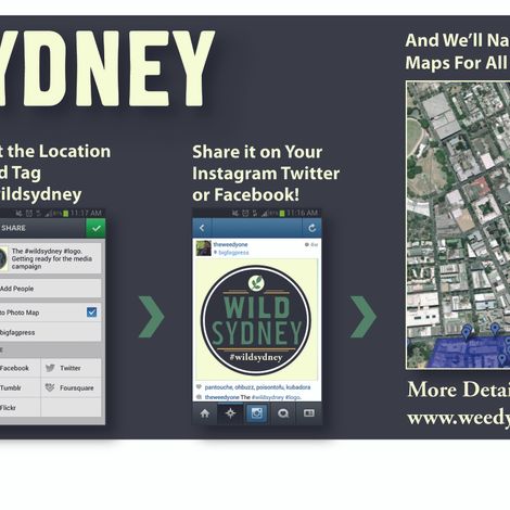
The idea is simple: by integrating hashtags calls from social media sites we are able to 'harvest' images and geolocate them onto a map.
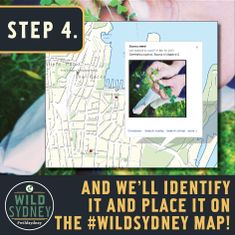
The return for the users is that the wild plants will then be identified for them and
informations on how to use, how to harvest, when to harvest will be presented as much as links and references.
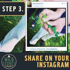
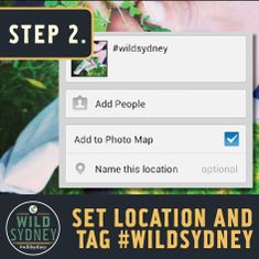
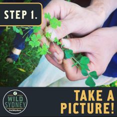
Because of what I do I get sent images all the times from people willing to know better what is growing around them. 'Can I eat this?' is a common sight on my wall. I now ask that they upload the image, tag and geolocate it so that it would automatically be placed on the #wildsydney map for all to benefit.
We already secured the support from other free maps, like Scrumpers Delight, now offline, but will be resuscitated through our project>>http://www.imagoforest.com.au/rs_ev.html <<
and will also integrate data from the Australian Virtual Herbarium >>avh.ala.org.au<< and the Environmental Protection Agency (to map polluted areas) >>http://www.epa.nsw.gov.au/<<
The scope is much bigger than that, we want eventually to map clean sites, best harvesting seasons, no-go areas, wildfood-nerds-forums and more.
Step one will be launched as part of an exhibition on Radical Cartography at Tin Shed Gallery on August 1.
Can you imagine? a map that will tell you the location and seasonal availability for dandelions? nettle? mulberries? pine mushrooms? bamboo shoots?
Wouldn't that be awesome?
Yes of course by mapping it all we would create competition, but also a platform for sharing information, an amplification of our knowledge of available resources and an amplification of our care for those resources.
There is no such a thing as waste, only under-utilised resource
:)